It is interesting to observe the identification of the Angus ‘cities’ and villages of our forebears in old maps of Angus. In a map of Britain dated about 1250 (partial image below – click to enlarge), in the region which is today Angus, Dundee can be identified, whilst the Antonine and Hadrian Walls are also highlighted. Also in the gallery below, Ainslie’s 1788 map is contemporary with the period when the young family of John Wilson of Laws was growing up and no doubt roaming the fields and hills about Laws Farm and district.
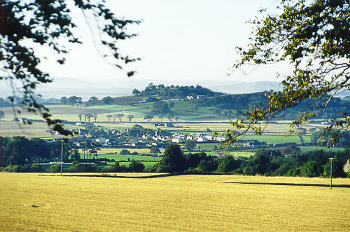
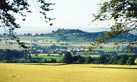
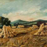
The recent image in the header above captures how the farms most probably would have looked even 200 years back – broad fields of cereal crops ripened and harvested, but back then piled in chimney-like haystacks to aid drying (see gallery early 19th century Scottish image). It shows in the fore the fields of Templehall farm leading down to a strip settlement running left/right across middle of the image called Drumsturdiemuir, and adjoining beyond that, spread across the hills is Laws Farm, at the peak of which the ancient vitrified Celtic fort remains today. This link gives an interesting description.
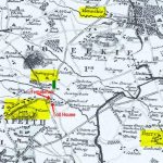
Our “Bonnie William”, as he came to be called, was just 6 years old when Ainslie’s mapping survey was conducted. No doubt William and his family observed the process. The map identifies homes dotted along DrumsturdyMoor (just Drumsturdy today) roadway and on the Laws farm side of the roadway also. Maps such as Ainslie’s were the forerunner of today’s highly detailed Ordnance Survey Maps – equally intended to record every topographical, locational, and construction detail with as much accuracy as was then possible.
The Ainslie map indicates more clearly the precise housing detail which Ainslie captured – in a sense Ainslee has created an ‘aerial photograph’ of the home in which our forebears lived – so leaving us to muse as to which one it was.
We may be certain that one of the little black boxes on the map along the Drumsturdy Moor strip of homes is that in which John Wilson and Margaret Bowman lived and had their children. Successive parish baptismal records from 1773 to 1784 for William and his brothers/sisters refer either to Laws or to Drumsturdy as the location of their abode, but it is very likely that they lived for most of this period at only the one address on the Laws side of the roadway, for which reference either to Laws or Drumsturdy would have been accurate. Templehall Farm was at the northern end of Drumsturdiemuir, opposite the Arbroath turnpike Toll house.
Some of the oldest references found in the literature actually refer to ‘Drumsturdy Laws’ as a single location – literally, ‘the hills (Laws) on the Drumsturdy Moors’. Later in the period the family relocated further along the road as Parish records we have uncovered show that Margaret Bowman was resident at ‘Templehall’ when she died in 1784, and further that her husband John lived on at this location with his second wife Margaret Ferrier through into the 19th century.
Observe the Toll house highlighted on the of Laws Farm side of Drumsturdiemuir. About that time there was also an Inn on the opposite side of the road to the left of Templehall called Forbes Inn; this provided food and accommodations and at this location travellers on this road, which was a main ‘pike’ between Dundee and Arbroath, would stop-over or rest whilst coach horses were changed. Travellers then paid a toll as they proceeded further on to Arbroath.
The residence and land immediately across the road from the Tollhouse carried the name Templehall – not identified by that name on Ainslie’s map (it is referenced in other documents of that time – we have identified it with the red arrow), but it is shown in later maps, and clearly named in Parish records in the 1780s when Ainslie made his map. No doubt it was the name of a particular property then rather than a locational name, but today it is the latter.
It is also apparent on the 1926 survey map that there were by then many fewer homes along the Drumsturdy-Laws strip, particularly on the Laws side than there were in 1788 (there are even less today).
Note that Newbigging was a single property in 1788; the Newbigging village emerged later and we have marked in green its location.
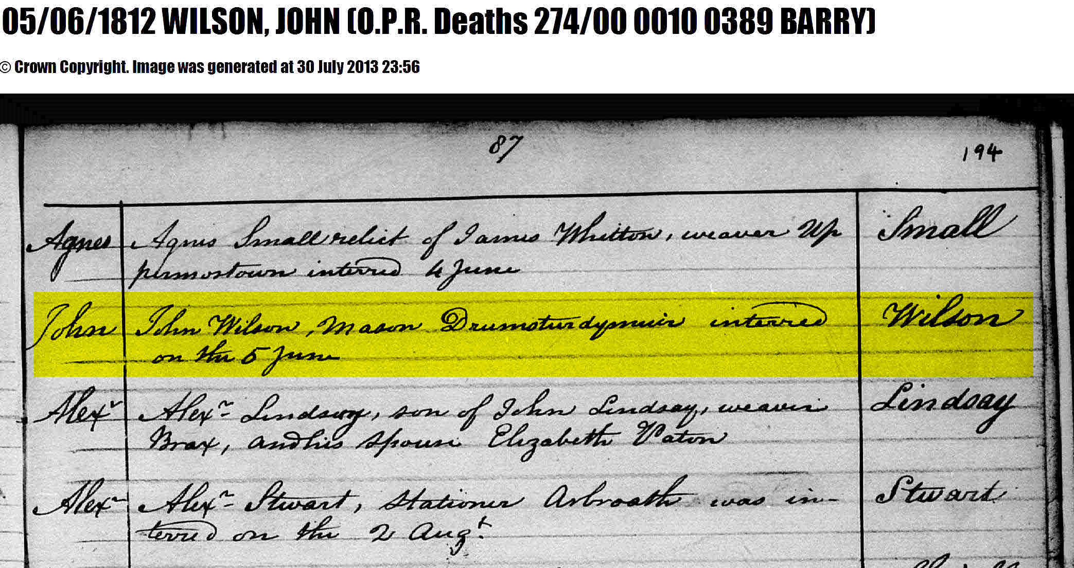
Also on Ainslie’s map is Barry Village and the farmlands around it – this is where Margaret Williamson was at some time resident, and where William’s mother Margaret Bowman and at least two of her children (Matilda and George) are buried, and where two children from the Margaret Ferrier union are buried – John Wilson is also buried there (confirmed in 2013 – see BDM file below). The old Barry Church and cemetery location (there are only remnant ruins of the church today) is highlighted in yellow.
Readers may also note a fine dotted line just to the left of the Toll running towards the north and also passing by the Newbigging property to the line’s right – this is the border between the parishes of Monifieth and Monikie.
-
- Ainslie Map 1788

-
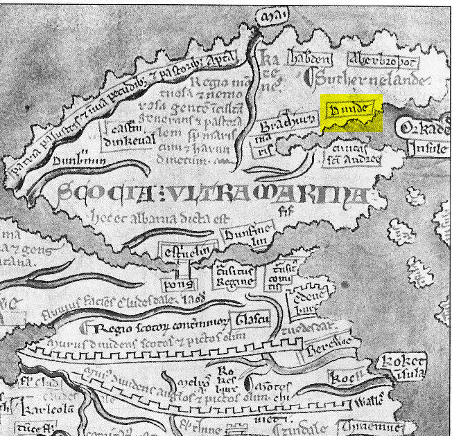
- Scotland Map 1250 -with Dundee and Hadrian’s Wall
-
- 19th century Scottish Haystacks
-
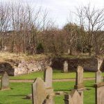
- Old Barry Churchyard

-
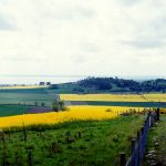
- Canola and Raspberries, Laws Hill

-
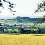
- Newbigging Village with Laws Hill farm in the background